HOME SURVEYS / DE
Level 3 Building Survey in Darley Dale.
Understand the defects, repairs and decisions behind a more complex home.
Level 3 from £570Confirm your total with the property details
A Level 3 Building Survey in Darley Dale costs from £570, fixed. Understand the home before you commit: a named, RICS-regulated practice, a clear report and a conversation afterwards.
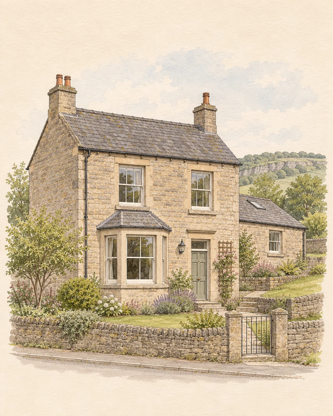 View larger illustration
Stone house on a stepped plot. Fictional architectural study; not a photographed local address.
- 01What meets the back wall
- 02When was the rear wing added
- 03Can both sides of a boundary be reached
01 / THE PRICE, EXPLAINED
Your home.
Your fixed price.
Level 2 from £335, Level 3 from £570. The property type, bedrooms and purchase price set your total. These examples use the current booking rate card.
No tax or SurveyChoice booking fee is added afterwards. Your exact postcode checks available practice coverage. Rate card last updated 20 August 2026.
| Property | Purchase price | Level 2 | Level 3 |
|---|---|---|---|
| 1–2 bedroom flat | Up to £250,000 | £335 | £570 |
| 3 bedroom house | Up to £250,000 | £365 | £600 |
| 4 bedroom detached house | £250,000–£350,000 | £510 | £745 |
02 / KNOW THE LOCAL PICTURE
Stone house on a stepped plot.
Darley Dale: this guide uses DE4 as local postcode references. Districts cross settlement and council boundaries; use the complete property postcode for matching and formal searches.
Discuss Level 3 for an older, substantially altered, unusually constructed or visibly concerning Darley Dale property. Ask for drawings, records and repair dates. Check how the higher roof drains past the lower roof. Agree access and any separate specialist investigations before booking.
Buying a later home or a new build?
Choose the inspection for the home you are buying: its construction, condition and alterations matter alongside its age.
A later home being resold
A later house may benefit from Level 3 where substantial alterations, unusual construction or visible defects need a more detailed assessment. For a straightforward home in reasonable condition, discuss whether Level 2 would be sufficient.
Request records for later work, building-control completion documents and any remaining warranty cover. For a flat, also ask about shared parts, planned works and the managing agent’s records.
Compare Level 2 for this homeBuying a brand-new home from a developer
Ask which inspection you need: a pre-completion or snagging inspection and a home survey have different agreed scopes. Confirm access, timing, the developer’s outstanding-work list and the warranty terms. A Level 2 or Level 3 quote here does not include a separate snagging inspection.
Snagging or a home survey?The local housing mix
Darley Dale Town Council publishes a review of proposed housing sites. Use that for local planning context and check the district planning register for the home itself before making decisions about access, drainage or future work.
Your Darley Dale viewing checklist.
01What meets the back wall?
Compare paths and garden levels with the floor inside and note any gullies or retaining walls.
02When was the rear wing added?
Ask for drawings, records and repair dates. Check how the higher roof drains past the lower roof.
03Can both sides of a boundary be reached?
Ask who owns the wall and whether access for inspection or repairs depends on neighbouring land.
03 / BEYOND THE FIRST IMPRESSION
Darley Dale: records and access for a closer inspection
Compare paths and garden levels with the floor inside and note any gullies or retaining walls. Ask for drawings, records and repair dates. Check how the higher roof drains past the lower roof. Ask who owns the wall and whether access for inspection or repairs depends on neighbouring land.
04 / PUBLIC RECORDS / DARLEY DALE
Darley Dale,
on the record.
Official figures for homes in and around Darley Dale: what was built and when, what has sold, what is protected and who holds the files. They describe the area. They are not findings about the home you are buying.
How Darley Dale grew
The Domesday Book of 1086 records Darley as seven villagers and a priest, settled near St Helen's Church at Churchtown, the oldest part of the parish; the church is of the 12th century. Other small settlements took shape later, most in the last two to three hundred years, among them Farley, Darley Hillside, Two Dales and Hackney, and in the 1800s the place became known as Darleys in the Dale for its scattered hamlets. The remains of five quarries and a disused flax mill recall its industry, and the benefaction of the industrialist Joseph Whitworth, who extended Stancliffe Hall in the 1880s, gave the town the Whitworth Institute, opened in the late 19th century.
From Darley Dale Neighbourhood Plan 2019–2033 (2020) (opens in a new tab), Darley Dale Town Council.
The homes in numbers
1,494 households in the 2 census neighbourhoods that best match Darley Dale. The marker on each bar shows the England and Wales share.
| Homes | Darley Dale | England and Wales |
|---|---|---|
| Terraced | 24% | 23% |
| Semi-detached | 30% | 32% |
| Detached | 36% | 23% |
| Flats and maisonettes | 11% | 22% |
70% of households own their home, 12% rent privately and 18% rent from a council or housing association.
| Homes | Darley Dale | England and Wales |
|---|---|---|
| Before 1900 | 15% | 15% |
| 1900 to 1918 | 4% | 5% |
| 1919 to 1939 | 15% | 14% |
| 1945 to 1964 | 13% | 16% |
| 1965 to 1982 | 19% | 18% |
| 1983 to 1999 | 21% | 12% |
| 2000 to 2009 | 3% | 7% |
| 2010 onwards | 8% | 12% |
What homes sold for
£241,250median price paid across 58 sales, 1 October 2025 to 30 September 2026
| Type | Median paid | Sales |
|---|---|---|
| Terraced | £210,000 | 17 |
| Semi-detached | £230,000 | 17 |
| Detached | £396,750 | 20 |
Standard sales registered with HM Land Registry; recent months are incomplete. A median says nothing about the value or condition of one home.
Protected buildings and places
- Listed buildings
- 26
- 0 Grade I, 3 Grade II*, 23 Grade II
- Conservation areas
- None recorded
- In Historic England’s dataset, which is not complete
- Scheduled monuments
- 1
- 1 registered park or garden
- Heritage at risk
- 0
- Entries on the 2026 register
What the list holds, grouped by the main word in each entry’s listed name
- 11 houses, cottages and halls
- 7 inns, shops, schools and public buildings
- 3 memorials, walls, gates and street furniture
- 3 bridges, canal and railway structures
- 1 churches and chapels
- 1 other named buildings
Treat the split as a guide; the list entry itself is the record.
Highest-graded entries nearby
Conservation areas
None appear in Historic England’s dataset for this area.
Boundaries decide what applies to a house. Confirm the address on Derbyshire Dales District Council’s conservation area pages (opens in a new tab).
Scheduled monuments include Darley Bridge (opens in a new tab). Registered parks and gardens include Whitworth Institute (opens in a new tab).
Flood warning areas
The Environment Agency maintains 4 flood warning areas within 1.4 km of the centre of Darley Dale, covering River Derwent, Bradwell Brook, Dale Brook. Each one covers particular streets, not the whole town.
- River Derwent at Darley Dale (opens in a new tab)
- River Derwent at Churchtown and Northwood (opens in a new tab)
- River Derwent at Darley Bridge (opens in a new tab)
- River Derwent at Matlock (opens in a new tab)
For one address, use Check the long term flood risk (opens in a new tab) and ask the seller in writing whether the property has flooded.
Coal mining
None of the postcodes measured for Darley Dale are in the coal mining reporting area, the area where the Mining Remediation Authority recommends a mining report. Other kinds of mining are recorded separately.
A share of postcodes says nothing about one plot. For an address, use Check if a property is affected by coal mining (opens in a new tab) or the Mining Remediation Authority map viewer (opens in a new tab); a conveyancer normally orders the report with the other searches.
Who holds the records
Derbyshire Dales District Council (opens in a new tab) decides planning applications and holds building control records for Darley Dale. Derbyshire County Council (opens in a new tab) is responsible for roads and for local flood risk management. Civil parish: Darley Dale, Northwood and Tinkersley.
A newer estate can have its own appointed water company in place of the regional one. 3% of the postcodes measured in Darley Dale are inside such an area; the water bill names the supplier.
What this suggests you check
Late twentieth-century homes are the largest group
34% of homes in Darley Dale were built between 1973 and 1999, against 21% across England and Wales. Ask how old the roof covering, windows, boiler and wiring are, and for the approvals behind any extension or loft conversion. The house survey checklist.
Check heritage status before planning any work
Historic England records 26 listed buildings in and around Darley Dale. Listing and conservation-area controls apply address by address, so confirm the status of the exact property before budgeting for windows, roofs or extensions. Listed and period buildings.
Look up the flood record for the address
There are 4 flood warning areas within 1.4 km of the centre of Darley Dale, including on the River Derwent and Bradwell Brook. A warning area covers particular streets, so check the long-term risk for the exact postcode and ask the seller about past flooding.
Put the survey fee in proportion
A Level 3 survey from £570 is about 0.2% of the median price paid for a home in Darley Dale (£241,250). Your own fixed fee appears once you enter the property's details. See the full price register.
See these figures for all 316 towns, side by side. The table opens at Darley Dale.
Sources and method. Records compiled 12 November 2026; council links checked 12 November 2026; building control, parish council and water company links added 14 November 2026.
Each place starts from the extent Ordnance Survey publishes for it in OS Open Names. Housing, tenure and sale figures use the live residential postcodes inside that extent that belong to the same ONS built-up area as the place itself; census and Valuation Office figures cover the 2021 neighbourhoods (LSOAs) with at least half of their postcodes in that set. Heritage records are those inside the extent, and flood areas those within the stated distance of its centre, so both can include neighbouring settlements. Coal figures are the share of the same postcodes that fall inside the Mining Remediation Authority's published areas. The water and sewerage companies are those whose published boundaries hold the same postcodes; a small appointed company serving one estate is counted separately and not named.
This is the area measured for Darley Dale: 91 live residential postcodes in an extent 2.8 km wide and 3.2 km tall.
- OS Open Names, served by Postcodes.io (opens in a new tab), Ordnance Survey. Contains OS data © Crown copyright and database right 2026.
- ONS Postcode Directory and Built Up Areas (2024) (opens in a new tab), Office for National Statistics. Source: Office for National Statistics licensed under the Open Government Licence v3.0. Contains OS data © Crown copyright and database right 2026. Contains Royal Mail data © Royal Mail copyright and database right 2026.
- Census 2021, tables TS044 and TS054 (opens in a new tab), Office for National Statistics. Source: Office for National Statistics licensed under the Open Government Licence v3.0.
- Council Tax: stock of properties 2026, table CTSOP4.1 (opens in a new tab), Valuation Office Agency. Source: Valuation Office Agency, licensed under the Open Government Licence v3.0.
- Price Paid Data (opens in a new tab), HM Land Registry. Contains HM Land Registry data © Crown copyright and database right 2026. This data is licensed under the Open Government Licence v3.0.
- National Heritage List for England, Conservation Areas and Heritage at Risk Register 2026 (opens in a new tab), Historic England. © Historic England 2026. Contains Ordnance Survey data © Crown copyright and database right 2026. The Historic England GIS Data contained in this material was obtained on 12 November 2026. The most publicly available up to date Historic England GIS Data can be obtained from HistoricEngland.org.uk.
- Flood warning and flood alert areas (opens in a new tab), Environment Agency. This uses Environment Agency flood and river level data from the real-time data API (Beta).
- Development High Risk Area and Development Low Risk Area (opens in a new tab), Mining Remediation Authority. Contains public sector information licensed under the Open Government Licence v3.0.
- Find your local council and local service links (opens in a new tab), GOV.UK. Contains public sector information licensed under the Open Government Licence v3.0.
- Find an archive (opens in a new tab), The National Archives. Contains public sector information licensed under the Open Government Licence v3.0.
- Water Company Boundaries and appointed wastewater boundaries (opens in a new tab), Water UK and the water companies, on the Stream open data portal. Water Company Boundaries © Water UK. Appointed wastewater boundaries © Yorkshire Water, United Utilities, Severn Trent Water, Anglian Water Services and Dŵr Cymru Welsh Water. Licensed under CC BY 4.0 (https://creativecommons.org/licenses/by/4.0/). The shares of postcodes are worked out by SurveyChoice from the boundaries, simplified to 10 metres.
- List of .gov.uk domain names (opens in a new tab), Government Digital Service. Contains public sector information licensed under the Open Government Licence v3.0.
05 / A CLEARER NEXT STEP
A report you can
make decisions with.
For older, altered, unusual, larger or visibly defective homes, get a deeper explanation of visible defects, repair options and priorities within the agreed inspection scope.
- 01
The inspection
The practice inspects the accessible property to the agreed survey level.
- 02
The written findings
Condition ratings and clear advice help you understand the issues and the next enquiries.
- 03
The conversation
A follow-up with the inspecting practice helps you work through the report. The practice confirms access and report timing after instruction.
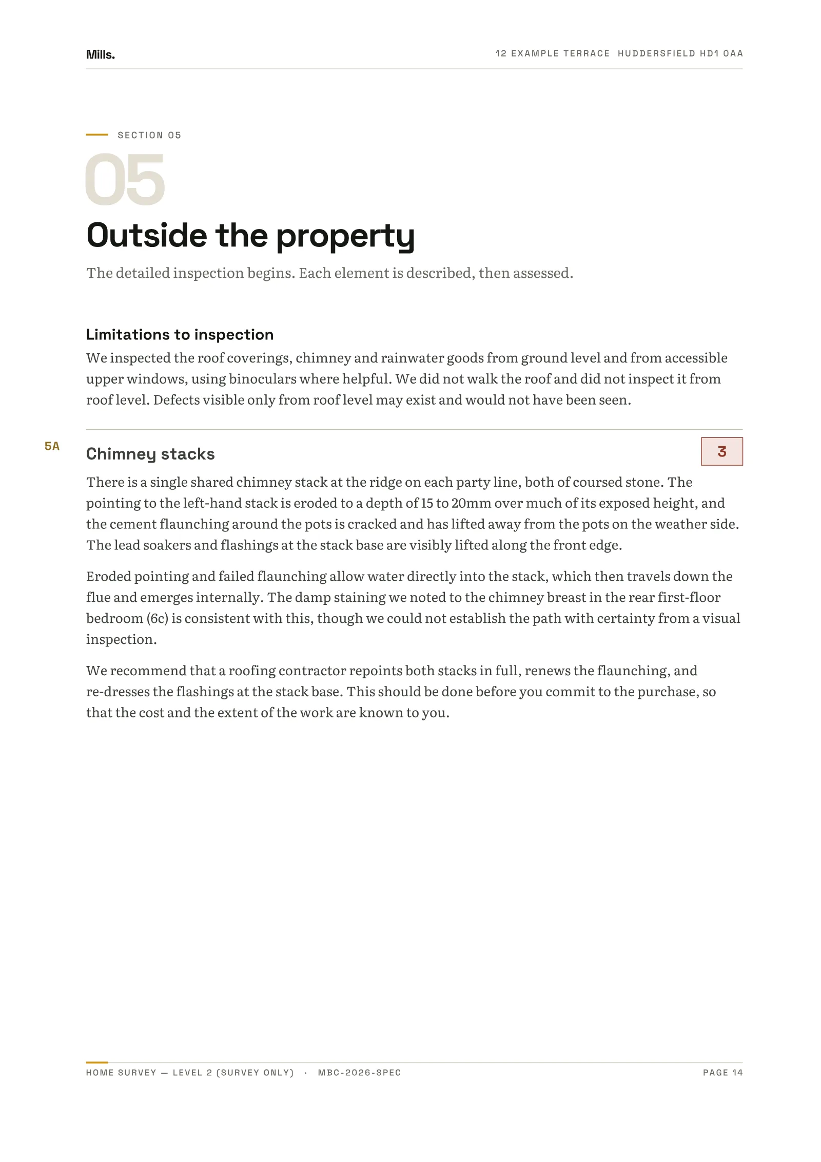
The illustrated specimen is a Level 2 report, rather than a Level 3 sample. Explore the Level 2 specimen.
Explore a page of the report
What could actually be seen?
The specimen records a ground-level inspection, with accessible upper windows and binoculars where helpful. It also says the roof was not walked. Read the limits alongside the findings; unseen areas remain uncertain.
Your Darley Dale survey, at a glance.
- Who inspects
- A named, RICS-regulated practice’s surveyor. Review the practice and its terms before you pay.
- What you get
- A written report to the RICS Home Survey Standard and a follow-up conversation with the inspecting practice.
- Coverage
- Check your exact postcode within DE4. Practice capacity can vary.
PROFESSIONAL ASSURANCE
RICS-regulated practices.
Checked before matching.
- 01PRACTICE CHECKRICS regulation and insurance checked
A practice cannot be quoted until its RICS firm registration and professional indemnity insurance have been checked.
- 02RECOGNISED SCOPECurrent RICS standard
Delivered in line with the current RICS Home Survey Standard.
- 03CLEAR RESPONSIBILITYPlatform matched. Practice accountable.
SurveyChoice quotes, matches and books. The named practice delivers the professional service.
BEFORE YOU COMMIT / YOUR RESEARCH
Good questions.
Better information.
Bring the physical condition and the records together. Your surveyor explains accessible condition; your conveyancer investigates legal matters and the searches appropriate to your purchase.
Darley Dale Town Council property and heritage records
Darley Dale Town Council publishes a review of proposed housing sites. Use that for local planning context and check the district planning register for the home itself before making decisions about access, drainage or future work. Check current address mapping and individual listing separately; these records do not establish condition.
(opens in a new tab)OFFICIAL SOURCE / 02Find the planning register for the address
Confirm the local authority by full postcode, particularly beyond the town boundary. Compare approved plans and decisions with the present layout; request building-control completion records separately.
(opens in a new tab)Types of house survey explained
All six things called a survey during a purchase — and which of them is actually yours.
Read the guide BUYER’S READING / 02House survey access checklist: what to ask the seller to prepare
A survey’s usefulness depends partly on what can be reached and seen safely. Prepare access early so avoidable restrictions do not become unanswered report entries.
Read the guide BUYER’S READING / 03House survey before exchange: timing and unresolved defects
Leave time not only for the inspection, but for the report, your questions and any investigations that could change your purchase decision.
Read the guideSTRAIGHT ANSWERS
Before you ask.
01How much does a Level 3 Building Survey cost in Darley Dale?+
Published Level 3 prices currently start from £570. The exact fixed price depends on the agreed purchase-price band, property type and bedroom count—not a sales callback. The live quote checks those inputs and the exact outward postcode.
02Do you have RICS surveyors in Darley Dale?+
Enter the property postcode to check current availability in Darley Dale. SurveyChoice matches eligible properties to a named, RICS-regulated practice. You see the practice and its professional terms before completing the instruction.
03Which house survey do I need in Darley Dale?+
Level 2 is commonly suited to a conventional home in reasonable condition. Level 3 is the deeper option for an older, altered, unusual, larger or visibly defective property. The building and your concerns matter more than the town name.
04Can I book a survey in Darley Dale (DE4)?+
The districts listed on this page are covered today. Availability can still vary with the practice’s capacity, so check the property’s exact postcode before entering your contact details.
05Who carries out the survey?+
The quote engine matches the property to an available RICS-regulated practice, and the practice’s RICS surveyor carries out the inspection. SurveyChoice checks every practice’s RICS regulation, insurance and terms; the practice is named before the instruction is completed.
06How can I compare cheap house surveys in Darley Dale?+
Compare the same property type, purchase-price band, bedroom count and survey level. Check the final total, any valuation, inspection scope and who provides the report. SurveyChoice shows a fixed total before contact details; its published price is not a claim to be the cheapest provider for every property.
07When can you inspect my property in Darley Dale?+
Enter the exact postcode to check whether a practice can quote. The practice confirms access and report timing after instruction. If you have an exchange deadline, discuss it before committing; a starting price does not promise a particular inspection date.
MORE LOCATIONS / East Midlands
Explore surveys across East Midlands.
All areasDARLEY DALE / YOUR NEXT MOVE
A new home.
A clearer picture.
Start with the postcode. See the fixed price and review the practice before you commit.
Still choosing a survey? We can help.